
AGRICULTURE
The tech world is transforming farming machinery beyond the limits of our imagination. And now the entry of drones into agriculture makes it more fascinating.
Drones have opened up new possibilities in agriculture and changed how Australian farmers work. We believe that they should not be put needlessly at risk in doing their jobs. People are priceless and robots are cheap, so by implementing drone technologies to do dull, dirty, and dangerous jobs, we can minimize the risk to which farmers are exposed. We are particularly interested in helping to connect and grow Australia’s drone world so that we can get to and adapt to future technologies, faster. The use of drone technology is only going to grow in future generations, so we’ve developed our Farming drones.

Farmers are turning to drone technology to gather real time and precise data that allows them to observe trends and monitor potential issues throughout the year. By understanding potential issues early enough, they are able to act before it’s too late and maximise efficiency.
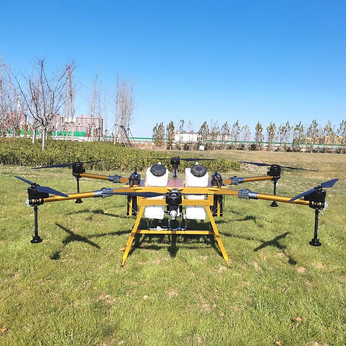
First Spraying Drone in Agricultural RPA industry with 32L pesticide payload to stand along the line of today's industry level spraying equipment on our farm lands.
• Spraying Capacity: 16.5 - 18.5 Hectares Per Hour
• Maximum Altitude: 400ft
• Tank Capacity: 32L (16L + 16L)
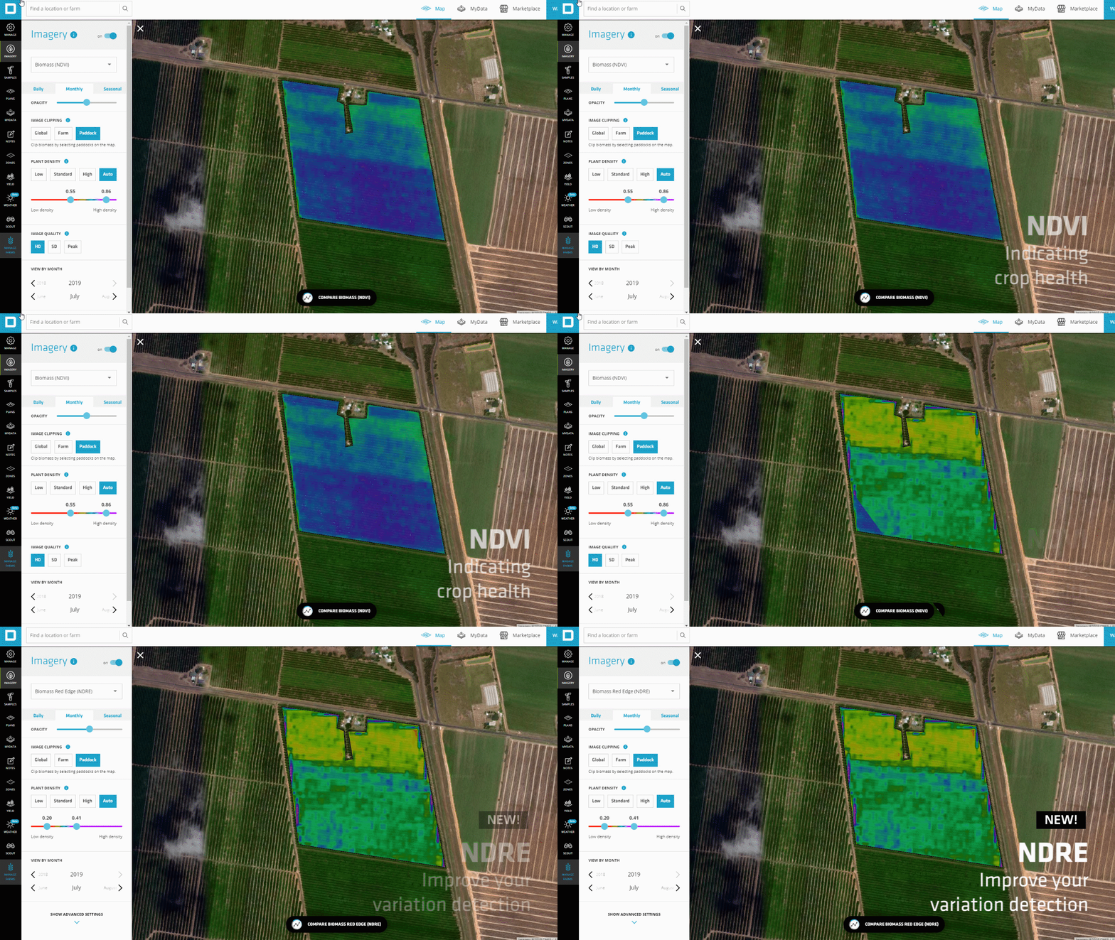
By Utilizing NDVI data generated from our mapping Drones, Spot staying is achievable to best possible level. In Most of Australian Agricultural lands, Areas with prime need of spraying will not exceed 35% to 40% of actual farm land which can facilitate the upgrade to RPA with increased spraying capability from 16.5 - 18.5 Hectares to 45 - 50 hectares per hour.
Zord Amigo 3.2 (Farm Spraying)

BENEFITS FOR FARMLANDS

COMPACTION
Spraying Pesticides with drones will Void the tire marks of Today's Heavy weighted Farming machinery starting at 1 Ton and ranging till 3.5 Tonnes

SOIL FERTILITY LEVELS
Compaction results in the merging of fertile soil layers with Layers underneath making it harder on next ploughing resulting in reduced levels of Soil Fertility

USGAE OF PESTICIDE
Usage Of the NDVI module Drones can recognize good and bad plants (Crop & Weeds) deriving less usage of fertilizer while facilitating healthy lands for our Next Generations

Strong penetrability with Obstacle Avoidance Sensors (including fog, smoke, dust, light rain) & not affected by light
• Spraying Capacity: 12.5 - 14.5 Hectares Per Hour
• Maximum Altitude: 400ft
• Tank Capacity: 20L
• Power saving as it consumes only 1.5 watts
The obstacle avoidance radar module measures the relative distance between the drone and obstacles ahead to avoid them. The obstacle avoidance radar uses 2.4 gigahertz radar technology, which can work all day in strong light, high temperature, fog, dust, wind and night.
Zord Amigo 2.0 (Farm Spraying)
BENEFITS FOR FARMERS

PRIMARY INVESTMENT
Our farming drones are way cheaper than today's farm machinery. And cost efficiency will be at least 60% to 70%.

MAINTAINANCE
Void on Travelling, Canvoying vehicles, Insurances of Fleet and their regular Servicing expenses.

TIME & LABOUR
WIth GPS-guided drone systems, Time spent on-farm for spraying can be reduced while keeping Lands fertile.
The payload is 1.8 liters. It sprays pesticides and insecticides over wide areas effectively in shorter time spans with more precision. It is easier to disinfect larger spaces (e.g. stadiums), confined spaces (e.g. theatres), and remote areas (e.g. river channels with no access) than by using today's spraying methods.
Zord Amigo (Fogger)

Spraying
Our Spraying drones can stand as a great asset for farmers with smaller land bodies or farms with varied ground heights making it tougher for heavy machinery. Alongside, they can help in reducing the level of pesticides that were being

Crop health Analysis & Paddock Performance
Real time data acquisition using drone technologies will improve analysing the statistics in concern to Crop height, Paddock conditions, Health & vegetation Levels can be accessed with more Accuracy

Water mapping
Identification of underground water levels can be made easier with Lidar technologies. With help them, recognising dams with low water levels, blocked drains, Lands with poor under ground water levels can be made way easier than today's Traditional methods

Plant Counting& Yield Production
Precision attained via drone technologies can facilitate farmers to generate plant count with sophisticated levels of accuracy whilst helping them in forecasting yields obtained from the data acquired through Surveying farm land
NDVI
Technology

NDVI (normalized difference vegetation index) is a way to determine plant health using reflections. light rays of a crop leaf at certain frequencies. (Some waves are absorbed and others are reflected.) The traditional way to analyze NDVI data is through images acquired from satellites. And the well-known obstructions are weather conditions, Connectivity & Picture quality. Our drones have NDVI technology built-in. Spot spraying (by baselining data acquired by the drones) can be much more efficient in terms of time, labor, and pesticide use while reducing compaction to the lowest possible level. It could also be the solution for the fertile layers of land that are merged with lower layers by today’s heavy farm machinery. NDVI technology can help farmers:
• Estimate the amount of pesticide and fertilizer a crop needs
• Compensate for changes in lighting conditions, surface slope, exposure,
and external factors like groundwater level.

Broadacre farmers and agronomists are in a constant battle to produce bigger and better crop yields to fulfill global demand due to rapid population increase.
Broad Area & Speciality Crop

Livestock farmers are in a constant battle to monitor and survey large open areas of difficult terrain to monitor live stock and water sources.
Livestock Agriculture

Wildlife & Conservation efforts are one of the biggest benefactors. With increasing need to study climate-change, &the effects of human land use on the environment.
Wildlife & Conservation


